Geography
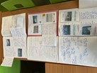
Geography is all about the world around us. At Wrockwardine Wood Junior School, our learning in Geography develops a curiosity and fascination about the world's physical and human characteristics, encouraging children to learn and explain the world around them. We teach pupils about diverse places, people, resources, and natural and human environments. Learning builds a deep understanding of the Earth’s key physical and human processes too. Teachers aim to enrich children’s knowledge and understanding of each aspect of geography by building on prior attained skills and knowledge from previous years as well as introducing new key concepts according to their year group. Our children will learn about global and local environments and where possible, receive a practical approach to learning. They will develop their geographical skills by interpreting a range of sources of geographical information, including maps, diagrams, globes, and aerial photographs appropriate to their year group. Our geography curriculum supports every pupil to achieve, develop resilience through challenge and enquiry, thrive in their learning as geographers and belong to an inclusive learning environment.
Key aspects of Geography:
- Locational knowledge - locate the world’s countries and the United Kingdom's cities using maps.
- Place knowledge - understand geographical similarities and differences through the study of human and physical geography of a region of the United Kingdom, a region in a European country, and a region within North or South America.
- Physical geography - climate zones, biomes and vegetation belts, rivers, mountains, volcanoes and earthquakes, and the water cycle.
- Human geography - types of settlement and land use, economic activity including trade links, and the distribution of natural resources including energy, food, minerals and water.
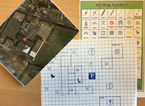
- Geographical skills - use maps, atlases, globes and digital mapping to locate countries and describe features. Use the eight points of a compass, six-figure grid references, symbols and key to build their knowledge of the United Kingdom and the wider world.
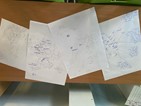
- Geographical fieldwork - use fieldwork to observe, measure, record and present the human and physical features in the local area using a range of methods, including sketch maps, plans and graphs, and digital technologies.


Geography Intent, Implementation and Impact Statement
Geography progression of skills


